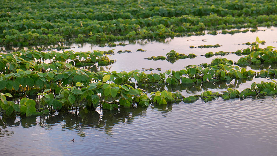
(Photo: Iowa Soybean Association / File Photo)
July rains leave mark on Iowa crops
August 7, 2025 | Kriss Nelson
July is hitting record books in the precipitation department as the second wettest on record.
With 153 years of statewide records, July 2025 is nearly an inch and a half shy of the record set in July 1993, the year of the Great Flood.
Although there has been some isolated flooding, why isn’t Iowa experiencing the effects of this precipitation as it did 32 years ago?
“The difference between 2025 and 1993 is we were dry in terms of soil profiles, and stream flows were lower coming into the season, so we had plenty of capacity to absorb the amount of moisture we received in late June through July,” says Justin Glisan, Iowa’s state climatologist.
A farmer’s report
Paul Kassel, Clay County farmer and District 1 director for the Iowa Soybean Association, says his farm received 11.5 inches of rain in July.
“We are in very good shape in terms of soil moisture,” he says. “We got a scare on Monday, July 28. Some winds approached derecho wind speeds. Fortunately, and surprisingly, crop damage was minimal. Some corn fields had some brittle snap stalk damage, but to my knowledge, there was no widespread damage to the corn or soybean crop.”
The excessive rain, on the other hand, has affected the soybean crop in Kassel’s area.
“The soybean crop damage may be better described as growth suppression,” he says. “There are areas in soybean fields where the soybean plants are stunted and appear light green to almost yellow. These suppressed areas correspond to areas in the field that need additional tile drainage.”
Why the rain?
With areas of the state receiving more than 10 inches of rain last month, Glisan explains it was thanks to the Gulf moisture gate being wide open, with a strong southerly flow through late June and July. That allowed a lot of moisture to stream into the Upper Midwest. The southern states have had a very active severe weather season, and their soil profiles are holding plenty of moisture to work with.
“Coming out of the 2020–2024 drought, which was the longest since the 1950s, it’s important for us to get that moist flow off the Gulf,” he says. “If the southern states are dry during the growing season, they can pull some of the moisture out of the air mass, which means less of it makes it to the Upper Midwest. Without that moisture, we lose the fuel thunderstorms need to develop.”
Another factor was the mid-level flow from the Pacific.
“There was monsoon moisture as well, and that was making its way into the Midwest,” says Glisan. “So you have two sources that provided a lot of moisture.”
The third week of July also set the stage for what Glisan calls “ridge riders,” which are disturbances that travel along the edge of a heat dome. That pattern led to the derecho early last week.
Although some endured devastating damage from severe weather, so far, summer 2025 is appearing less active than 2024.
“We have had severe weather, and if your farm was in the path of one of these events, it was impactful,” says Glisan. “Generally, this season we have had a lack of severe weather. We have been below normal in terms of tornadic activity, hail and wind events.
What’s ahead
Glisan says the eight-to-14-day outlook (Aug. 12–18) shows a stronger signal for above-normal temperatures and near-normal precipitation.
The forecast for late August shows an equal chance of temperatures and rainfall being below or close to average.
As harvest approaches, Glisan says he’s seeing warm and dry indicators, which is a favorable outlook for getting crops out of the field in September and October. But, in contrast to September 2024, the 22nd warmest and driest September on record, it's not expected to be as dry and warm.
Written by Kriss Nelson.
Back